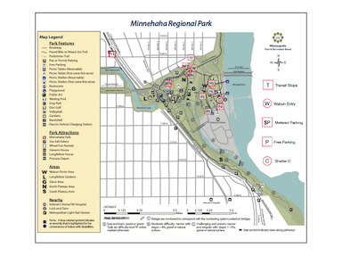
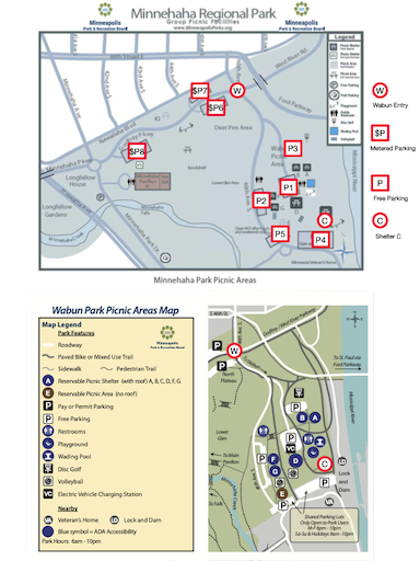
The Celebration is at Minnehaha Regional Park, Wabun Picnic Area Shelter "C".
The park is situated on the west side of the Mississippi River in south Minneapolis.
Wabun Picnic Area is along the Mississippi River bluff, east of the main park.
Wabun Shelter "C" is in the southeast corner of Wabun Picnic Area. The entry to Wabun
(marked with a "W" on the maps) is at the intersection of 46th Avenue and Godfrey Parkway.
Godfrey Parkway becomes West River Parkway east of the intersection.
The maps below are annotated to highlight the locations of Shelter C, the Wabun Entry,
transit stops, and several vehicle parking areas.
The shelter geo-coordinates are 44°54'54.8"N 93°12'14.0"W